Projects
Featured Media Coverage and Publications
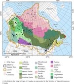
Medium Resolution Digital Elevation Model From Natural Resources Canada’s CanElevation Series (MRDEM-30)
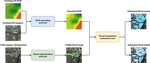
From Data to Action: FHIMP and the Future of Flood Risk Governance in Canada
Open Building Population Layer for Canada: A Game-Changer in High-Resolution Population Data
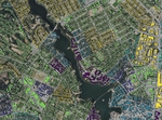
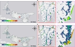
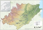
Large-scale flood modelling based on LiDAR data: a case study in the Southwest Miramichi watershed, New Brunswick, Canada
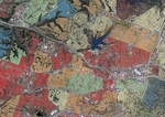
Post-wildfire boreal forest vegetation cover change mapping via information fusion for secondary disaster risk assessments
Pluvial flood modeling for coastal areas under future climate change – A case study for Prince Edward Island, Canada

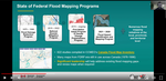
Global Flood Partnership: Flood Hazards in Canada: Update from the National Flood Mapping Program
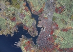
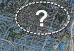
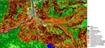
A rapid high-resolution multi-sensory urban flood mapping framework via DEM upscaling
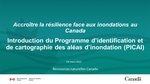
Accroître la résilience du Canada face aux inondations: introduction du nouveau Programme d'identification et de cartographie des aléas d'inondation (PICAI)
Hydrological and hydraulic modeling of concrete fuse plug operation for small dams

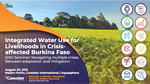
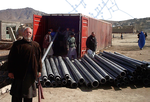
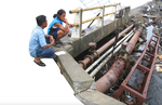
Integrated Water Use for Livelihoods in Crisis-affected Burkina Faso
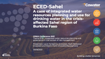
ECED-Sahel: A case of integrated water resources planning and use for drinking water in the crisis-affected Sahel region of Burkina Faso
2017 Canadian Consulting Engineering Awards - Award of Excellence
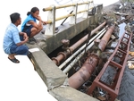
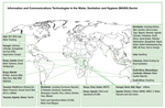
Unlocking the Potential of ICT to Improve Water and Sanitation Services
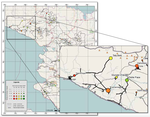
Leveraging GIS tools to improve water and sanitation infrastructure programming in Haiti
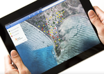
GPS and Google Earth for Development: How to create, share and collaborate with maps on the net
Maxim Fortin
Water Resources Engineer
Biography
Engineer specialized in hydrological and hydraulic modeling, flood mapping and geospatial data. Former Cowater Project Director, I spent more than 10 years addressing water resources management issues around the world. My career brought me all the way from water supply and flood mapping in the Sahel desert of West Africa, to post-earthquake water infrastructure vulnerability assessments in Haiti, decentralized wastewater management in remote communities of Alaska, hydraulic modeling in the Khyber Pakhtunkhwa Province of Pakistan, large-scale mobile surveys for water infrastructure assessments in Jordan and various other assignments in almost a dozen other countries.
In recent years, I refocused my work on hydrological and hydraulic modeling closer to home with Aquasphera, where I specialized in flood analysis, stormwater management, drainage, erosion control and river modeling with government and private partners here in Canada. I now work with Natural Resources Canada’s excellence Center in Mapping and Earth Observation (CCMEO) as an Engineering Advisor (Flood Modeling), providing expert advice for the implementation of various national-scale programs and R&D initiatives aimed at advancing flood mapping coverage in Canada.
In my spare time, I have fun applying geospatial analysis and data science tools to real world problems, especially flood-related! When not nerding out on flood or water issues, I also enjoy playing chess, woodworking and spending time with the little family.
Interests
- Hydrological and hydraulic modeling
- Flood mapping and flood risk management
- Drinking water supply (developing context)
- Geospatial data and analysis
Education
M.Sc. in Water and Waste Engineering
Loughborough University
B.Eng. in Water Engineering
Université Laval