Large-scale flood modelling based on LiDAR data: a case study in the Southwest Miramichi watershed, New Brunswick, Canada
Abstract
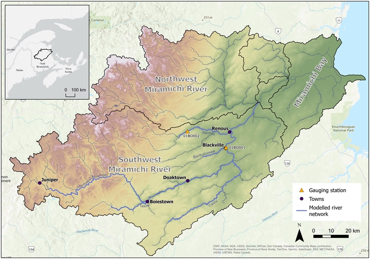
With Canada’s river basins extending over almost 10 million km2, producing flood maps sufficiently accurate to be used for planning purposes at a reasonable cost is a challenge. Bathymetric data, in particular, are difficult and expensive to obtain and represent a major challenge for regional or global flood models as it is clearly not realistic to acquire river bathymetry data for large territories. In this study, we present an improved version of a large-scale flood modelling approach developed in Quebec, where bathymetry is estimated from Manning’s equation based on LiDAR data water surface slope, and apply it to network of 512 km of rivers in the Southwest Miramichi watershed in New Brunswick, Canada. Comparison with a HEC-RAS model that did not include bathymetry highlights how crucial it is to correctly assess the bed elevation. When compared to the measured discharge and water level data at a gauging station, the HEC-RAS model systematically overestimates flood levels (bias of 2.36 m) whereas for the large-scale flood model the bias is 0.09 m and the RMSE 0.11 m. The semi-automated large-scale methodology took about 1 hr/km and was able to simulate flood levels for the Southwest Miramichi watershed at an unprecedented accuracy at this scale.
Large-scale flood modelling based on LiDAR data: a case study in the Southwest Miramichi watershed, New Brunswick, Canada
01 December 2024
Authors: Guénolé Choné, Iulia Mazgareanu, Pascale M. Biron, Thomas Buffin-Bélanger, François Larouche-Tremblay, Brian Perry & Maxim Fortin
Maxim Fortin
Water Resources Engineer
My professional interests include hydrological and hydraulic modeling, flood mapping and geospatial data analysis.